Click
![]() to open the Route Designer panel.
to open the Route Designer panel.
Click the Select Route drop-down box and select <New>.
Instead of “Route1” type “Active Pass to Tsawwassen” in the Route field.
Leave Enable checked.
Live
“Lime” in Color.
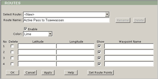
Then you need to add way points; please click the Set Route Points button and you will be redirected to the map view.
Draw
the route by left-clicking on the map.
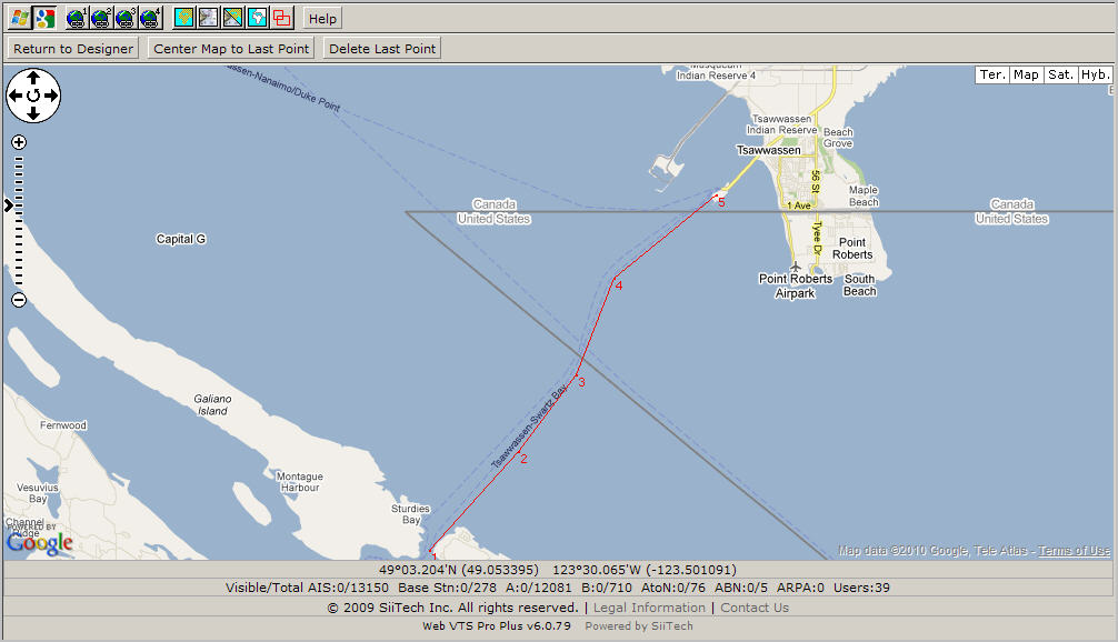
Click the Return to Designer button to return the Route Designer panel.
Type the names of the way points in Waypoint Name.
Change
the color to "Yellow" in Color.
Tip:
You could clear any Show
check box and a way point will not be displayed on the screen.
For example: if we
have to make a really accurate route along the river then we could
zoom in any part of the river and build a route with many way points.
In this case we probably
don't need to show
all way points on the chart and get distance and ETA to all way points,
so we could leave only those way points that are really necessary
to monitor.
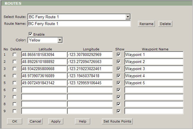
Next click the OK button to save your changes and return to the main view.
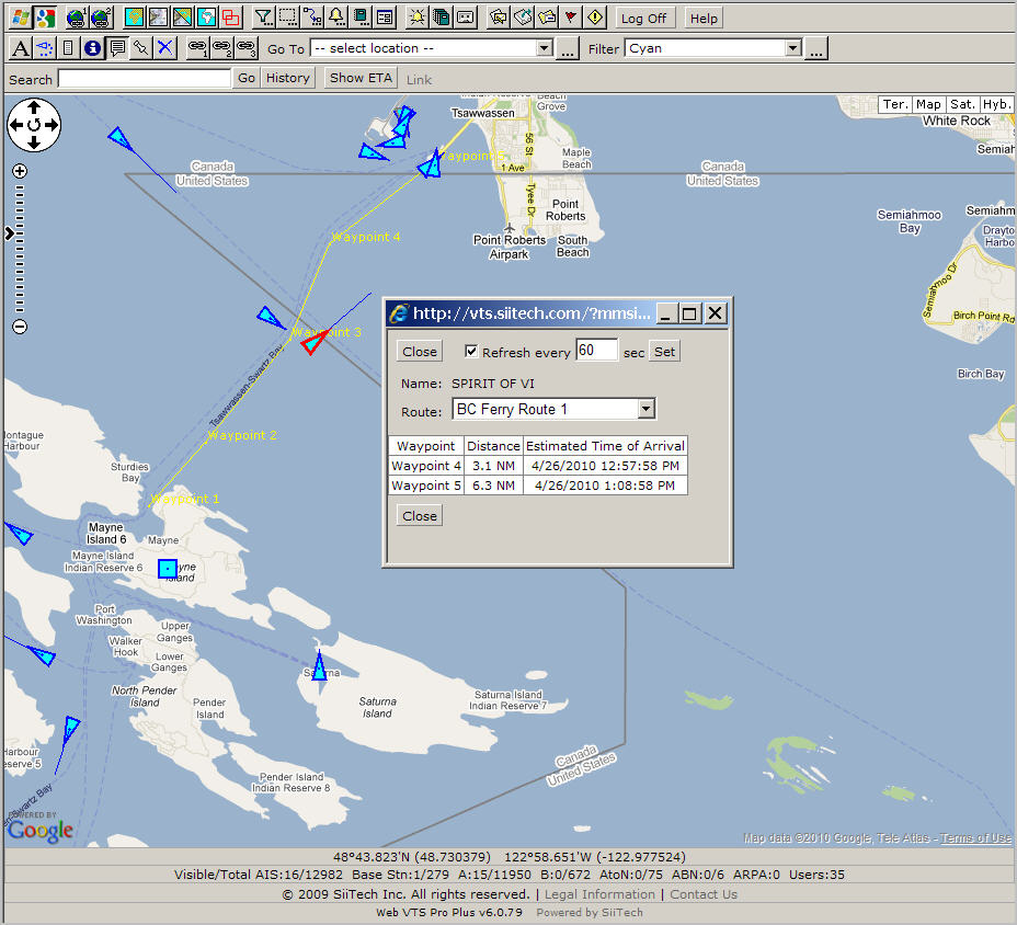
Select
any vessel of interest to get a distance and ETA.
Tip: Click on any desired vessel (in our case it is the ferry
- Spirit of Vancouver Island).
Click the Show ETA button and the ETA panel appears.
Select
the route from the Route drop-down box and you could see distance
and ETA to all waypoints.
Tip:
You could keep this floating
panel open and all data will be refreshed automatically base on the
settings.